- BBC Radio 2 In The Park confirmed as Preston’s mystery music festival
- Preston City Council local elections 2024 candidates list set out
- Blog Preston reaches crowdfunding goal for expanded arts and culture coverage
- Harris Institute owners move to squash ‘for sale’ rumours
- “Unacceptable” and “must do better” as Preston records highest rough sleeper count since records began
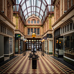
Historic maps reveal Preston’s long lost buildings and rivers
Posted on - 5th September, 2021 - 7:00pm | Author - Geoffrey Whittaker | Posted in - History, Preston News
Maps are a great way of seeing how Preston has developed over the last 350 years, revealing some long lost buildings and rivers.
AdvertisementThe map above shows the original core of the town in 1650. The medieval field names are included. Plots of land were often owned by different people. As a result, one owner could have plots spread all over the town. Some of the field names were later used as street or district names.

The core of Preston developed around the Church and Marketplace.
Early medieval Preston
Preston had many advantages that led to its development as a key Market town. For example it had easy access to the sea and the Ribble Valley to the East. It was also close to the lowest fording point on the River Ribble. Additionally, due to its geographical location, it became a natural intersection point for the main North-South and East–West roads.
The Church and Marketplace came first. With Stoneygate, behind the church, being the original road to the river crossing at Walton-le-Dale. Churches were usually built on high ground. Consequently, the ridge along Churchgate and Fishergate became the main axis of the town.
Preston gets a Charter
Charters were granted to towns by the King. They brought about an early form of regional government with the town’s burgesses (officials) being able to trade freely and mange their own courts. Charters also allowed the use of woodlands to the north of Preston. Preston received its first charter in 1179; this cost the Burgesses 100 Marks. Little changed in the layout of Preston until the beginning of the industrial revolution.
The 18th century in Preston

Lang’s map and survey of Preston in 1774, shows a still largely agricultural town. Animals roamed the streets and the poor farmed the town fields.
The survey lists 95 town fields with 68 at less than ten acres. Some plots owned by individuals were very small.
The medieval Burgess plots were now being converted into poor quality housing. As a result, the rich facades on Friargate and Fishergate hid up to three hovels behind. Churchgate was another area of crowded housing, heading west. One owner held 16 of these houses.
As Preston was a market town, shops were of great value. One shop under the Town Hall was worth £6. Two butchers’ shops with rooms over were worth £4. Stables, gardens and orchards are also listed in the survey.
The 19th century
The biggest changes occurred in the 19th century. Maps from 1824 to 1885 show massive growth.

This era boasted some wonderful maps, which are works of art and show a growing pride in the town.
By 1824 buildings were advancing towards the river and some green space had been reserved for parks. The canal can be seen, along with the tramway down to the Ribble. Winckley Square is notable. Side streets follow the lines of the Burgess plots.
In 1832, the electoral reform bill gave power to the larger towns so that they could elect MPs directly. Before this, only the aristocracy could vote.
Preston in 1844

The growth by 1844 is remarkable; the railway arrived and this spurred development to the north of the station. The first textile mills were built close to the railway. The railway line to the Docks can also be seen, passing under Fishergate. Hand loom weavers’ houses proliferated at the north end of Friargate.

Nationally, the Whigs dominated politics until the 1850s. By this time the Whigs were supported by the ‘new money’ industrialists and mercantile class, whereas the Tories were supported by the aristocracy, land owners and farmers.
In 1846, the Tory prime minister Sir Robert Peel, repealed the corn laws. He was supported by the Whigs but not by a number of his own party. Consequently he resigned shortly after the vote.
Preston in 1885
By the end of the century most of the old strip fields have been built on and urban sprawl was approaching Moor Park. Two cotton manufacturers dominated – John Watson and Co, and John Horrocks. Watson was notorious for ’employing’ orphans shipped up from London.

Railways now approached Preston from all directions and street tramways extended to the edges of town.
Read more: See the latest Preston news and headlines

 Preston in pictures


 View more
Advertisement
Subscribe to the newsletter
View more
Advertisement
Subscribe to the newsletter
Sign up below to receive Blog Preston's email newsletter. It wings its way into inboxes every Sunday and Wednesday rounding up our top stories and more.
Advertisement News by locationFind news by location, select an area of your choice to be kept up to date with the latest goings on.
The Preston GuideDiscover local businesses and services near you.

 Advertisement
Categories
Advertisement
Categories
Find news by category, select an category of your choice to be kept up to date with the latest goings on.